
Seville, beautiful and diverse
Seville, beautiful and diverse
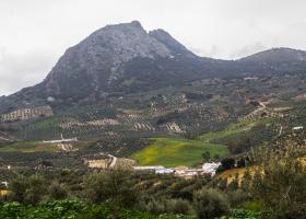
The Peñón de Algámitas is found in the Sierra del Tablón, one of the mountain formations that make up the Sierra Sur. It is a great isolated mass of calcareous rock, with an altitude of 1121 m, making it the second highest peak in the province of Seville (the highest is the Terril, located in the same mountain range).
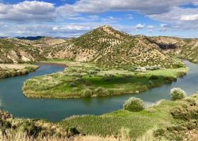
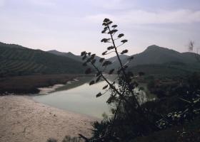
In Badolatosa, specifically at kilometre 13 of the road that connects this town with the district of Corcoya, there is a dirt track leading to a small watchtower. From there you can observe the beauty of the meander formed by the River Genil as it runs around the mountain range and the small islet formed by the whimsical flow of the river.
The Sierra de Becerrero massif, also called Sierra de Estepa, has been declared a Mountain Area of Environmental Interest, and is located between the towns of Estepa, Gilena, Pedrera and Lora de Estepa, rising sharply from a fairly flat environment.
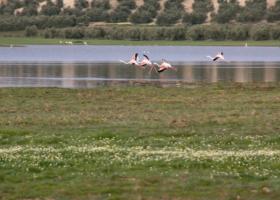
The Laguna del Gosque is an endorheic and seasonal wetland. It is located on flat terrain, in an area of undulating relief and gentle hills, near the Sierra de los Caballos, in the south of the province of Seville.
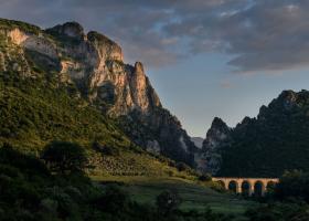
The Peñón de Zaframagón is located between the towns of Olvera (Cádiz) and Coripe (Seville), in the last foothills of the Grazalema mountain range, where the Sub-Baetic range borders the River Guadalquivir depression.
From a geological point of view, the Malpasillo reservoir is part of the Sub-Baetic unit of the Betic mountain ranges.
The Tajos de Mogarejo, an area of great scenic value declared a Natural Monument by the Department of the Environment of the Junta de Andalucía, are a large depression in the terrain, in a predominantly flat area, forming a gorge with steep walls over 30 m in height, inside which are created ideal conditions for the development of unique vegetation, very different from that of