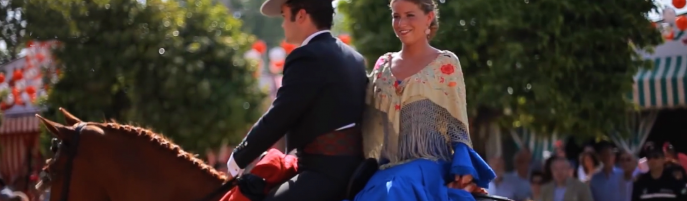
Seville, beautiful and diverse
Seville, beautiful and diverse
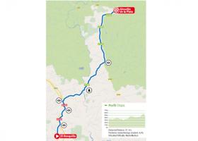
We leave Ronquillo on the N630, driving approximately 4.5 km to the turn-off to Almadén de la Plata, on the A8175 road. We will travel 8.5 km until we reach a crossroads where we will have to continue on the left, always towards Almadén de la Plata, along the same A8175, for 9 km, until we reach Almadén. In this stage we will enter the Sierra Norte Natural Park.
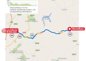
We leave the A-375 in the direction of Seville, looking for the turning to the left that indicates Las Cabezas de San Juan on the A-8128. After 28 kilometres we reach a junction with the A371 where we turn right towards Las Cabezas de San Juan. We will continue along this road for 12.5 kilometres until we reach the municipality, where we will arrive at Avenida Dr. Fleming.
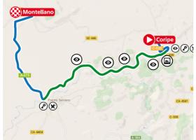
We leave Coripe along the main avenue, looking for the signs to the Greenway along the A8126. We will descend a steep slope to the River Guadalporcún and, after crossing it, we will have to turn right following the signs to the Greenway.
The route of the Greenway is 15 kilometres long and passes through 10 tunnels, the largest of which are illuminated.
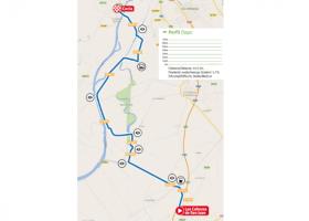
We will start the route on Avenida Dr. Fleming in Las Cabezas de San Juan until we reach a roundabout. We will have to turn right on Calle Blas Infante. After 100 metres we come to a crossroads where we must continue straight on along the Avenida de Jesús Nazareno, where we leave Las Cabezas and take the SE-5208 road.
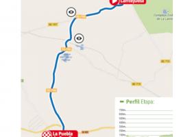
Coming from Fuentes de Andalucía on the A-407 and about 300 metres away from the entrance, tourists should take the turn-off that leads to the municipality of Lantejuela. After 31 metres along Calle Virgen del Rosario, tourists must turn right into Calle Blas Infante and continue until leaving the village on the SE-7201 road towards La Puebla de Cazalla.
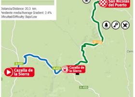
We leave Cazalla de la Sierra until we reach the exit of the village, on the A455 towards the train station and Constantina. After descending 8km along the A455 we will arrive at the Cazalla/Constantina Station, cross the railway tracks, and after about 200 metres, we will come to a crossroads where we will have to turn right towards Constantina.
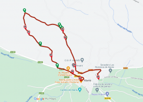
The trail runs along a path in the urban area of Alanís, which surrounds the Cerro del Cura (Priest's Hill), following a circular route. From the village, look for the beginning of the Guadalcanal road and follow it for 300 metres until you see the path on your right.