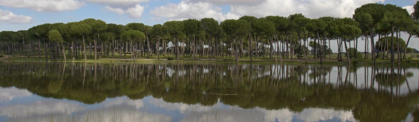
Natural areas
More than three hundred natural sites and nature reserves
Natural areas
More than three hundred natural sites and nature reserves
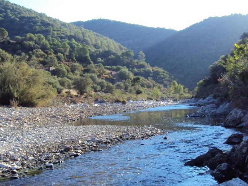
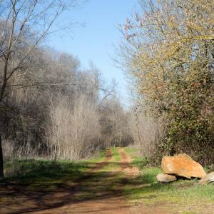
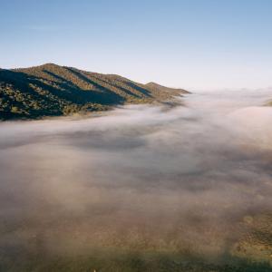
The River Viar is one of the tributaries of the right bank of the Guadalquivir, which it joins between Cantillana and Villaverde del Río. Its source is in the Extremadura municipality of Monesterio, and it is 124 km in length. At its arrival in Seville it is interrupted by the Pintado reservoir and from there it runs through the central area of the Sierra Norte through the tectonic trench of the Viar, a deep, steep-walled valley that prevents communication between the eastern and western sectors of the Sierra Norte, giving rise to very beautiful, well-preserved, rugged landscapes.
Apart from the geomorphological interest of its course, the river retains sections of original gallery forest, with ash, silver poplar, black poplar and willow, and crosses areas of Mediterranean vegetation. The wildlife is abundant and varied.
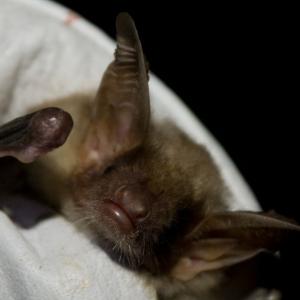
In the Cazalla de la Sierra section there are birds of prey of great interest such as the black and tawny vultures, and many other bird species can be observed at the Bajos de la Jádraga viewpoint, near the Pintado. The inaccessibility of the river as it passes through the Sierra Norte has made it possible for rare animal species, highly sensitive to human pressure, such as the otter and the lynx, to thrive.
One of the most important tributary streams of the Viar on its Cazalla de la Sierra bank, is the Candelero, which flows into the Viar with a great 50-metre waterfall known as La Chorrera. The substratum is granite and slate, and, in some areas, the stream flows through a high-walled ravine, where there are large specimens of wild olive trees and a dense thicket containing Andalusia's largest population of the prickly juniper shrub. Another important feature of this area is the presence of a colony of vultures, which take advantage of the isolated conditions and abundance of food.
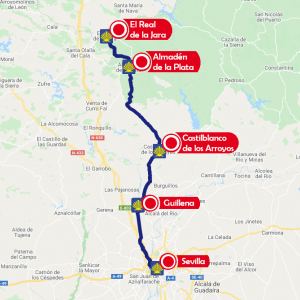
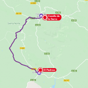
Access is free. You can reach the Viar from Cazalla de la Sierra by taking the SE-179 road in the direction of El Real de la Jara. To reach the Candelero stream, you have to take the road from El Pintado to La Ganchosa.
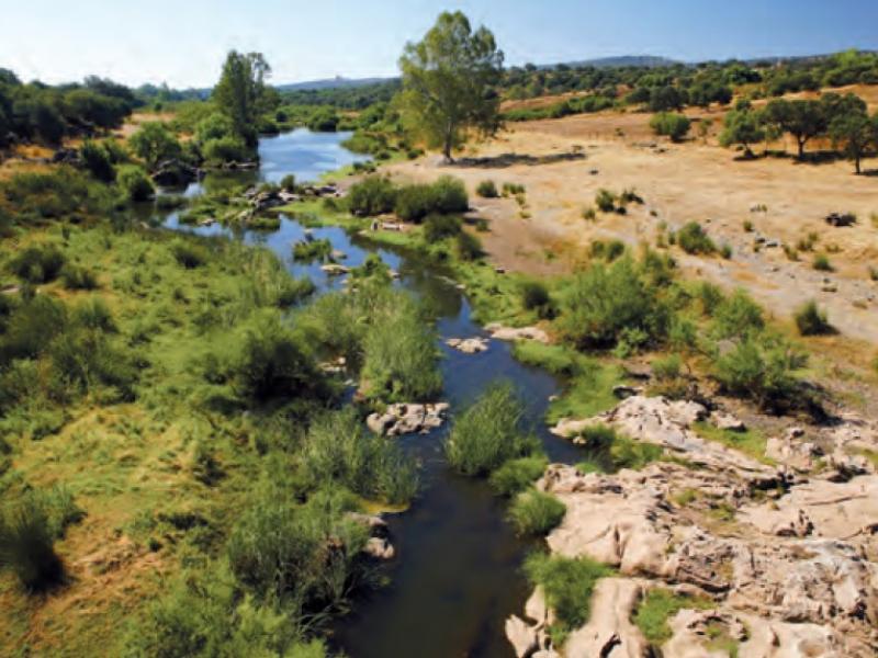
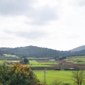
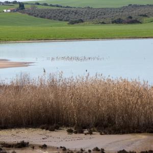
The River Viar acts as the eastern boundary of the municipality of Castilblanco de los Arroyos, separating it from the municipality of El Pedroso. Today, the northern part of this stretch of the river is affected by the Melonares reservoir, whose dam is located near the A-3102 road that links these two municipalities. The Viar is one of the few rivers in the province that retains some sections of its original gallery vegetation. In the area downstream of the reservoir, the river is in its medium-low section, crossing dehesas very sparsely vegetated with holm oak, wild olive and some cork oak amongst Mediterranean scrub and grassland. On the banks of the river there is well-developed riparian shrub and tree vegetation.
Access: Free. The area of the River Viar in Castilblanco is about 12 km from the town centre in the direction of El Pedroso, along the A-3102 road.
The river Viar acts as the western boundary of the municipality of El Pedroso, separating it from the municipality of Castilblanco de los Arroyos. Today, the stretch of the river from where it enters the municipality to the A-3102 road is interrupted by the Melonares reservoir. In the southern part of the municipality, downstream from the reservoir, the Viar runs outside the Sierra Norte Natural Park, in the medium-low course of the river, which crosses areas of dehesa interspersed with shrubby and herbaceous riverside vegetation.
Access is free from the A-3102 road in the direction of Castilblanco de los Arroyos.
The River Viar has sections of great interest on its passage through El Real de la Jara. This is one of the wildest areas of the Natural Park due to its special geomorphological characteristics, which have been a decisive factor in the isolation of the area. The river, which marks the boundary between the towns of El Real de la Jara and Cazalla de la Sierra, is extremely rich in terms of birdlife, with the presence of black storks, black and griffon vultures and other remarkable birds of prey living on the rocky walls that border the river.
Access is free. It can be reached by the SE-179 road in the direction of Cazalla de la Sierra, from which there are several footpaths leading to the river, such as the Vulture Trail.
The River Viar runs through the municipality of Cantillana from north to south, crossing the mountainous area to the north and the extensive agricultural area that extends as far as its mouth on the Guadalquivir, very near Villaverde del Río.
In the northern part of its course through the municipality of Cantillana, the Viar runs through dehesas of holm oak interspersed with a variety of Mediterranean scrub species. In this area, in addition to birds such as red kites, mammals such as badgers, wild cats and mongoose can be found, and the river itself is home to species of great interest, such as the European pond turtle, which is classified as "vulnerable" in Andalusia.
In the surroundings of the River Viar, to the north of the town of Cantillana, the areas of La Zanoria and Las Asperillas are worthy of mention. In the latter, there are two flour mills, Molino Perdido and Molino Pajarero, in an area with riverside vegetation consisting predominantly of black poplar, oleander and tamarisk.
Access is free. From Cantillana, you can reach the River Viar on the A-432 road in the direction of El Pedroso and at kilometre 10, at the "Venta de Tomás", you turn left into the "Colada de Cazalla", which leads to the river.


0 comments
New comment
The comments are moderated, so it takes a while to appear. If they contain offensive language they will not be published.