
Seville enchants
Seville enchants
20 search results for 'MONTELLANO'
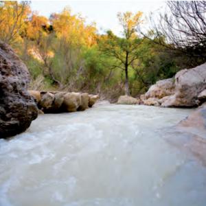
Although the River Guadalete, which discharges into the Atlantic Ocean, runs almost entirely through the province of Cadiz, it crosses the southern part of the municipality of Montellano, flowing parallel to the Sierra Greenway. It rises in the north of Sierra de Grazalema and travels 157 km to El Puerto de Santa María in Cadiz. The approximate total area is 710.34 ha.
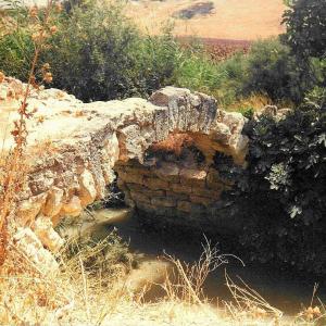
A small Roman construction that crosses the stream found on the old road that linked Tarifa and Ronda with Seville. It is very close to the A-376 El Coronil-Montellano road, about 6 kilometres from the town centre.
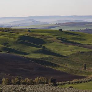
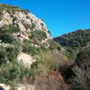
The Sierra de Montellano, also known as the Sierra de San Pablo, on whose slopes the town is located, is a limestone formation that reaches an altitude of up to 600 m, and which preserves natural vegetation of great interest for a town whose surrounding area is occupied largely by arable crops and olive groves.
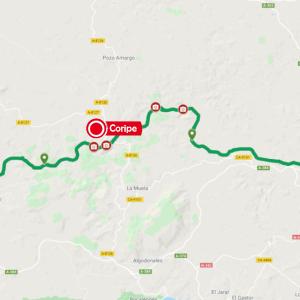
The Sierra Greenway alternates between the provinces of Seville and Cadiz. Coripe, El Coronil and Montellano are the mountain villages on the Seville side.
All these villages, immersed in the Sierra Sur of Seville, are typical of the region, with whitewashed walls, flowerpots and Moorish roofs.

Discover this Sevillian region that borders the provinces of Cádiz and Málaga. In the Sierra Sur, you will enjoy a unique natural setting, where the highest peak in the province of Seville, El Terril, is located. And you will find a wide range of rural tourism activities in all of its towns.
The Tajos de Mogarejo, an area of great scenic value declared a Natural Monument by the Department of the Environment of the Junta de Andalucía, are a large depression in the terrain, in a predominantly flat area, forming a gorge with steep walls over 30 m in height, inside which are created ideal conditions for the development of unique vegetation, very different from that of